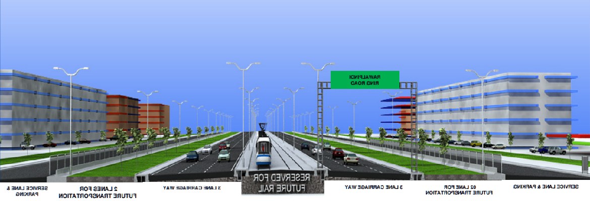
Rawalpindi: Federal Minister for Petroleum Ghulam Sarwar Khan recently said that Rawalpindi Ring Road (RRR) project would not be confined to the city alone but stretch over 100 kilometres to encircle both Islamabad and Rawalpindi, a news source reported. As per the publication, the project is expected to accommodate 50,000 vehicles on a daily basis.
What is Rawalpindi Ring Road’s road route?
The minister stated that the RRR would start from Chani Sher Alam near Rawat and end at Thalian in Rawalpindi – near the motorway. About half of the total length of RRR, which is from Rawat to Thaliyan interchange, is located in Rawalpindi, while the remaining road passes through the capital city – ‘covering Shah Allah Ditta, Siri Saral, Margalla Road, Kohsar, F-series sectors, Bhara Kahu, and Kallar Sayedan’ – before returning back to Rawat in Rawalpindi.
Read: Punjab govt adds Rawalpindi District in cities’ improvement initiative
Sarwar Khan said that the said project would take two years to complete.
Previously, the authorities had formed a Project Management Unit (PMU) to manage and oversee the development of RRR. To this effect, Zeeruk was employed to prepare PC-1 of the project and execute its feasibility report. The project is a joint venture of Engineering General Consultant and Zeeruk. The Punjab government earmarked PKR 10 million for conducting the feasibility report.
Read: River Hills IV-Bahria Town Rawalpindi gets on board with Zameen.com
Commissioner Rawalpindi has been assigned the job of the project director, while a deputy project director and the remaining staff including engineers, land acquisition collector, and resettlement planner will be employed in the coming days. Once the consultant firm finalise the PC-1 and present it to the government, the land acquisition and other relevant procedures will commence.


