Home » Construction » How Will Malir Expressway Better the Commute System in Karachi?
IN THIS POST
Project Overview
Project Location
Salient Features
Latest Updates
Pakistan, over the past couple of years, has witnessed a slew of reforms and critical initiatives, especially in the transportation and road-construction arena. These initiatives have not only given new hope to citizens but have also lured travellers from across the world to come to the country and witness it changing and growing. Following the federal government’s lead in launching mega transportation projects, the government of Sindh has reportedly approved the construction of the 39-kilometre-long Malir Expressway. The expressway will be constructed alongside the Malir River in collaboration with the local government.
Being Pakistan’s most trusted source of information, we have taken the responsibility to keep our readers updated with the latest information about all the mega projects in Sindh. So, here’s our take on the latest updates on Malir Expressway, Karachi.
Malir Expressway – Project Overview and the Reason behind its Construction

Before we start detailing the 39-km-long expressway situated alongside Malir River, let’s first understand the need for it with the help of a few critical stats.
Nobody can deny the fact that the city of lights is the biggest metropolitan city in Pakistan – not only in terms of population but also looking at the robust employment ratio, fastest-growing business potential, and extremely affordable housing schemes. This statement can be easily measured by the fact that Karachi was recently declared one of the most affordable cities in the world by the Economist Intelligence Unit (EIU).
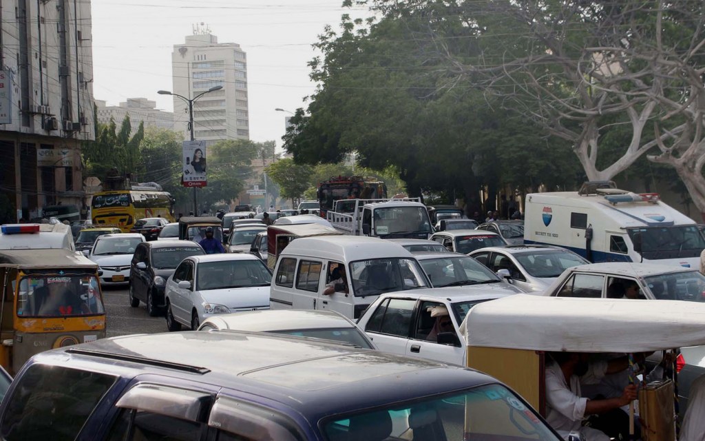
Owing to the employment potential and the quality of lifestyle, more and more people are moving to the city from across Pakistan, with the population of the city surpassing 14 million, as per the last census. Since the population only seems to be growing, it’s no wonder that this unprecedented growth is putting additional pressure on the city’s infrastructure, well-being, and overall development, sometimes squeezing it to a standstill. At the same time, more people moving to a city translates into more pedestrian traffic and vehicles on the road, which adds to traffic congestion and crucial resources going to waste, not to mention an increase in environmental hazards.
To keep the city moving, the Government of Sindh, in collaboration with the local government, has announced the construction of a four-lane dualised expressway starting from KPT Interchange to DHA City. According to the official plan, the project is divided into two phases for smoother execution and delivery. Here’s a peek into both phases:
Phase-I: During the first phase, the project will witness its transaction, preparation, and approval in the following manner:
- Project kickoff/need analysis
- Option analysis
- Risk analysis
- Financial roadmap
- Transaction structuring
- Assistance in preparation of RFPs
- Transaction approval
Phase-II: During the second phase, the project will be executed in the following order:
- Assistance in the request for proposal process
- Assistance in the bid evaluation process
- Negotiation, finalisation, and execution of the concession agreement
Now that you have all insightful information about this upcoming expressway in Karachi, let’s take you on a virtual tour of the proposed location and discussing the route map of Malir Expressway!
Location and Route Map of Malir Expressway
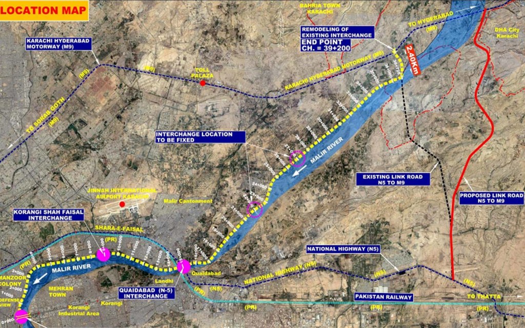
Beginning from KPT Interchange near Qayyumabad, this four-lane dualised expressway will run along the left bank of Malir River. The expressway will stretch to cover up to 39 kilometres and connect Korangi to Karachi-Hyderabad Motorway (M-9), and DHA City.
Given the proposed route map, Malir Expressway will be the shortest alternative route to M-9 Motorway from DHA Karachi. It will be designed for speedy yet safe travel from the urban areas of the city to nearby villages.
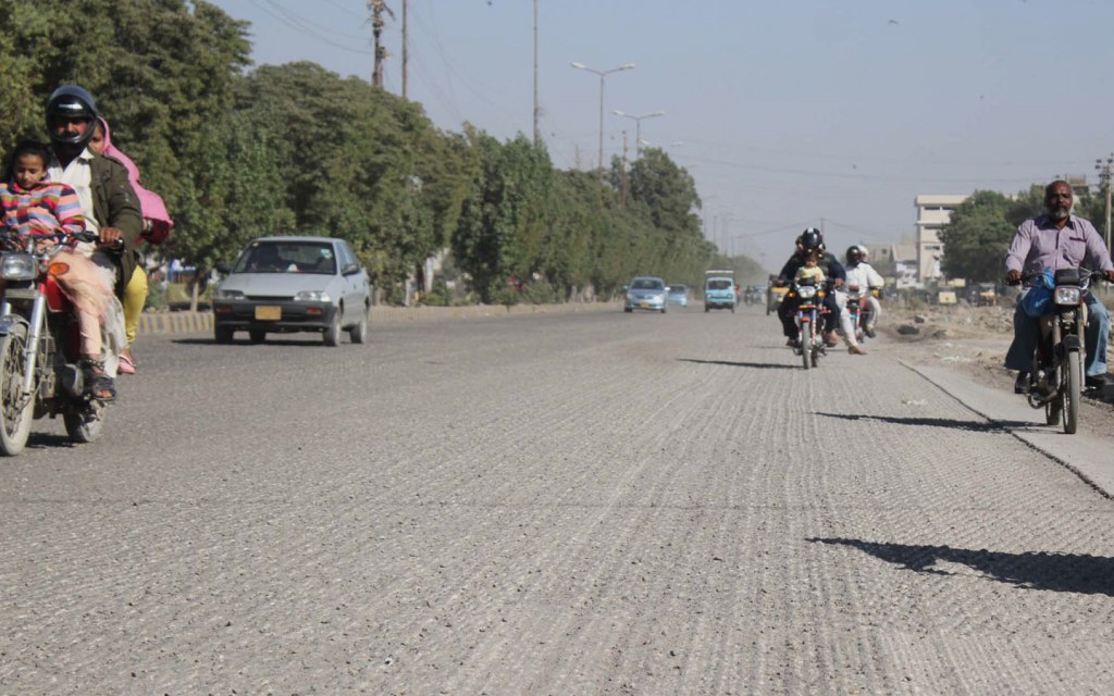
Presently, besides the two causeways on the left and right banks of Malir River, there are no paved roads present for a quick and smooth commute. The two causeways connect with the National Highway (N-5) and Quaidabad, respectively.
For further assistance on the location and route map of Malir Expressway, please have a look at the map below:

Image Credits: PPP Units Sindh
Salient Features of Malir Expressway

Whether you are living in Karachi, planning to visit the city, or completely relocate here soon, this expressway, without any doubt, will give you another stratum of comfort while navigating the depths and breadths of the city. In order to further breakdown the statistical information to you, we have included all the necessary information in the table below.
This table includes necessary data and figures regarding project length, facilities, number of interchanges, completion date, concession period, and other associated details:
| Project Length | 39 kilometres |
| Project Location | Malir River |
| Facility Type | Access Controlled High-Speed Toll Expressway |
| Typical Cross-Section | 4-Lane with 3m side shoulders, dual carriageway, and 7.9m raised central median for future expansion |
| Design Speed | 80 km/hour |
| Mode of Financing | PPP Equity Mode |
| Design and Completion Period | 36 months |
| Concession Period | 25+3 years |
| Interchanges | Korangi – Shah Faisal Colony Road Shahrah-e-Faisal (N-5) near Quaidabad Between 20-24 km Between 25-30 km Karachi-Hyderabad Motorway (M-9) |
| Number of flyovers | 3 |
| Number of other bridges | 5 |
| Number of Underpasses | 8 |
| Number of Cattle Creeps | 8 |
| Number of Culvers | 22 |
| Number of Weigh Bridges | 6 |
| Number of Toll Plazas | 21 |
Latest Updates on Malir Expressway

On 21st January 2020, the Chief Minister of Sindh Syed Murad Ali Shah formally approved the construction of Malir Expressway. The chief minister has also announced that the project will be constructed under the Public-Private Partnership (PPP) model and will be completed on an urgent basis to ease traffic congestion and further facilitate the lives of Karachiites.
Sharing some useful insights into the project, the Minister for Local Government Jam Khan Shoro said, “It will be a four-lane expressway along the Malir River starting from Hino Chowk and ending at the Super Highway (M-9) near Kathore. The length of the project will be 39-kilometres”.
Meanwhile, the CM Sindh expanded on the insight and said that Karachi is a major city of Pakistan with an ever-increasing population. This city is home to industrial areas and two major dry ports that severely need smart road networks and alternative routes to ease traffic congestion and expedite commute from one point to another.
According to the CM, “the project’s [Malir Expressway] main objective is to construct a strategic expressway to share the increased traffic in the north of Karachi”. He further added, “It would be providing fast access to the significant real estate projects along the route, hence decreasing the travelling time from the KPT flyover to the motorway to just 25 minutes”.
Initiated in the past week, the project is termed as a “historic gift” to Karachittes by the provincial chief executive. The project is scheduled to be completed on a priority basis and is anticipated to be delivered in two and a half years.
As much as Malir Expressway will help in easing the commute system within the city, it will also facilitate industries and industrial growth across the country.
This brings to the end of our blog. You can keep track of the latest updates on Malir Expressway by adding this page to your bookmarks. For more game-changing projects in Sindh and other parts of Pakistan, subscribe to Zameen Blog. Share your suggestions and feedback with us at blog@zameen.com.
If you have any further queries, message us on our Facebook page.


